Aquifer study targets local Missouri counties
Published 2:08 pm Friday, July 31, 2026

JEFFERSON CITY — An ongoing Missouri Department of Natural Resources aquifer study in Northeast Missouri hopes to benefit residents and farmers. The study’s latest work takes place this summer in Adair, Knox, and Lewis counties.
“The goal is to identify areas in these counties that have a higher sand or gravel content in the glacial drift and those areas that have the higher possibility of containing groundwater, which then leads to a higher possibility that citizens can drill wells on their farms for their house, for livestock, and for irrigation,” said Scott Kaden, groundwater section chief with the Missouri Geologic Survey-Water Resources Center in Rolla.
Northeast Missouri generally doesn’t have a good groundwater supply due to its geology. Usable water usually is found in shallow sand and gravel aquifers, while deeper aquifers are mineralized and unsuitable for drinking.
Glaciers during the last Ice Age pushed down material, covering up some aquifers, but the present-day studies can identify those locations and create maps to help landowners and drillers identify potential well sites.
This summer’s work mirrors what was done last year in Schuyler, Scotland, and Clark counties, with the project expected to wrap up in 2027, pending funding availability, with similar efforts in Macon, Shelby, and Marion counties.
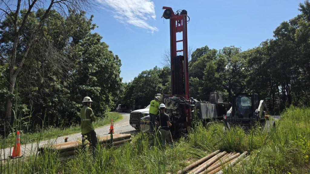
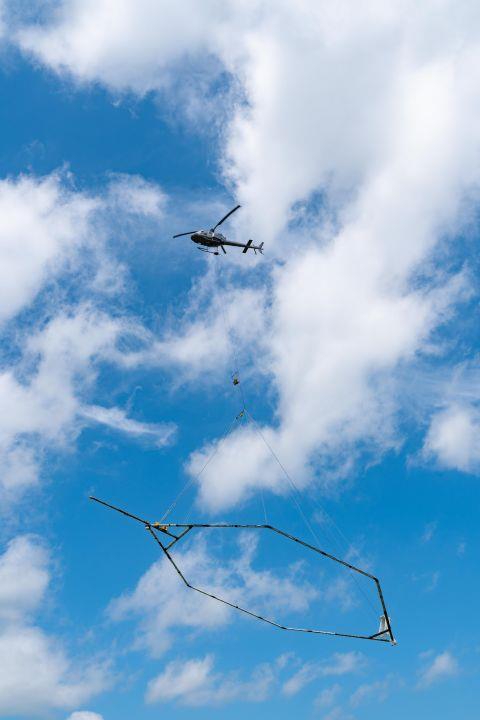
Helicopter flights, conducted in July, collected aeromagnetic data from the three counties, which helps determine the depth of glacial material and its composition, and work now underway involves drilling test holes as control points for that AEM data.
“We’re getting all of our drilling done this year, and that will include the other counties we’re really not studying yet,” Kaden said. “We’re drilling in Macon County, Shelby County, Knox County, and Adair County. The Macon and Shelby information will sit on the shelf until we get around to it.”
Lewis and Marion counties, based on their geology, won’t need test holes drilled.
“There was enough existing data there or the electromagnetic data can identify the contact between glacial drift and limestone pretty easily, and that’s what underlies those counties,” Kaden said. “We didn’t need to have it drilled to confirm that.”
Staff will be on-site in late summer or fall to collect passive seismic data, working in road rights-of-way and using equipment about the size of a shoebox to measure natural vibrations in the ground and also help determine the depth of bedrock and amount of surface material.
A contractor will pull the data together this fall and winter to create models of the aquifer in the three counties.
“Ultimately the idea is to provide sources of groundwater possibilities to help provide some drought resiliency and be less reliant on surface water,” Kaden said.
Many of Northeast Missouri’s public water supplies get water from surface water sources, including Mark Twain Lake, which often are most affected by drought. Since 2020, the state has experienced severe and prolonged periods of dryness.
Kaden made clear the study has no ties to the growing interest, and controversy, over data centers across the state.
“The concept of this Northeast Missouri project started several years ago and really has ties back into the 1950s when Missouri Geologic Survey did a similar type of project in Northwest Missouri. There’s a long history of identifying aquifers in northern Missouri. It’s not tied to data centers,” Kaden said.
“For generations those aquifers have been a vital resource for residents and the agricultural community in Northwest Missouri,” he said. “Our goals for this aquifer study are to see if we can create those same opportunities in Northeast Missouri that we did on the other side of the state.”